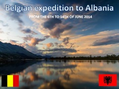
NB-DX-TEAM presents : ZA the ALBANIA DX-perience
After our expeditions to Liechtenstein in 2012 (HB0/ON6NB) and Jersey in 2013 (MJ/ON6NB), we are ready for a new challenge : ZA
THE PROJECT
A group of 10 belgian hams will be qrv from Albania (ZA) between the 6th and 15th of june 2014, we will be qrv between 6m and 80m, in SSB, CW,PSK and RTTY with an emphasis on the higher bands, propagation conditions permitting.
ORGANISATION
http://www.radioclubgrimbergen.be
http://www.on4pra.be
TIPS TO WORK US

ALWAYS use the CORRECT phonetic alphabet when calling in a pileup.
The phonetic alphabet (Alfa through Zulu) in radio traffic serves to avoid mistakes during exchanges of letters and words. To achieve this goal, the 26 alphabet letters have been attributed a unique word.
A DX station listens for these unique words in the pileup. His ears are harassed by the fusion of all these words (and figures) and fatigue increases. If we deviate from the standard words of the phonetic alphabet, it gets even more difficult for him.

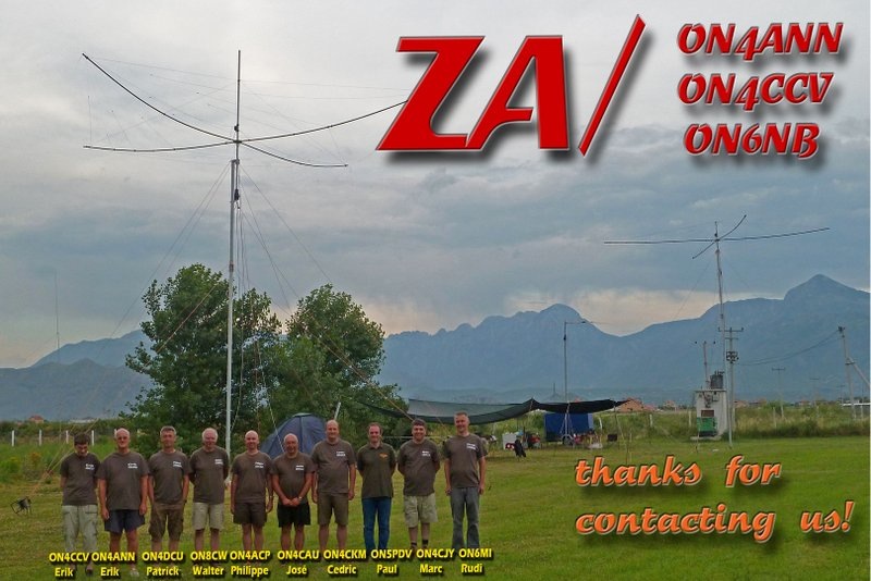
The Team- ZA

ON4ANN – ERIK ( TEAMLEADER AND SSB-OPERATOR)
ON4ACP – PHILIPPE ( CW-OPERATOR )
ON4CAU –JOSE ( CW – OPERATOR )
ON4CCV – ERIK ( SSB – OPERATOR )
ON4CJY – MARC ( SSB - OPERATOR )
ON4CKM – CEDRIC ( SSB - OPERATOR )
ON4DCU – PATRICK ( SSB – OPERATOR )
ON5PDV – PAUL ( SSB – DIGITAL MODES – OPERATOR )
ON6MI – RUDI ( SSB - OPERATOR )
ON8CW – WALTER ( DIGITAL MODES OPERATOR ) 

The objectives :
to have a lot of fun ;
to work as many stations as possible ;
return to belgium , tired but with a big smile on the face !! ;)
Pilote ON6QB, Frans
WITH THE HELP OF :
ON7FU Baluns


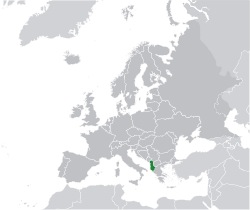
Albania has a total area of 28,748 square kilometres (11,100 square miles). It lies between latitudes 39° and 43° N, and mostly between longitudes 19° and 21° E (a small area lies east of 21°). Albania's coastline length is 476 km (296 mi)[55]:240 and extends along the Adriatic and Ionian Seas. The lowlands of the west face the Adriatic Sea.
The 70% of the country that is mountainous is rugged and often inaccessible from the outside. The highest mountain is Korab situated in the district of Dibër, reaching up to 2,764 metres (9,068 ft). The climate on the coast is typically Mediterranean with mild, wet winters and warm, sunny, and rather dry summers.
Inland conditions vary depending on elevation, but the higher areas above 1,500 m/5,000 ft are rather cold and frequently snowy in winter; here cold conditions with snow may linger into spring. Besides the capital city of Tirana, which has 420,000 inhabitants, the principal cities are Durrës, Korçë, Elbasan, Shkodër, Gjirokastër, Vlorë and Kukës. In Albanian grammar, a word can have indefinite and definite forms, and this also applies to city names: both Tiranë and Tirana, Shkodër and Shkodra are used.
The three largest and deepest tectonic lakes of the Balkan Peninsula are partly located in Albania. Lake Shkodër in the country's northwest has a surface which can vary between 370 km2 (140 sq mi) and 530 km2, out of which one third belongs to Albania and rest to Montenegro. The Albanian shoreline of the lake is 57 km (35 mi). Ohrid Lake is situated in the country's southeast and is shared between Albania and Republic of Macedonia. It has a maximal depth of 289 meters and a variety of unique flora and fauna can be found there, including "living fossils" and many endemic species. Because of its natural and historical value, Ohrid Lake is under the protection of UNESCO. There is also Butrinti Lake which is a small tectonic lake. It is located in the national park of Butrint.
Climate
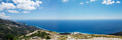
The Albanian riviera, panoramic view
With its coastline facing the Adriatic and Ionian seas, its highlands backed upon the elevated Balkan landmass, and the entire country lying at a latitude subject to a variety of weather patterns during the winter and summer seasons, Albania has a high number of climatic regions relative to its landmass. The coastal lowlands have typically Mediterranean weather; the highlands have a Mediterranean continental climate. In both the lowlands and the interior, the weather varies markedly from north to south.
The lowlands have mild winters, averaging about 7 °C (45 °F). Summer temperatures average 24 °C (75 °F). In the southern lowlands, temperatures average about 5 °C (9 °F) higher throughout the year. The difference is greater than 5 °C (9 °F) during the summer and somewhat less during the winter.
Inland temperatures are affected more by differences in elevation than by latitude or any other factor. Low winter temperatures in the mountains are caused by the continental air mass that dominates the weather in Eastern Europe and the Balkans. Northerly and northeasterly winds blow much of the time. Average summer temperatures are lower than in the coastal areas and much lower at higher elevations, but daily fluctuations are greater. Daytime maximum temperatures in the interior basins and river valleys are very high, but the nights are almost always cool.
Average precipitation is heavy, a result of the convergence of the prevailing airflow from the Mediterranean Sea and the continental air mass. Because they usually meet at the point where the terrain rises, the heaviest rain falls in the central uplands. Vertical currents initiated when the Mediterranean air is uplifted also cause frequent thunderstorms. Many of these storms are accompanied by high local winds and torrential downpours.
When the continental air mass is weak, Mediterranean winds drop their moisture farther inland. When there is a dominant continental air mass, cold air spills onto the lowland areas, which occurs most frequently in the winter. Because the season's lower temperatures damage olive trees and citrus fruits, groves and orchards are restricted to sheltered places with southern and western exposures, even in areas with high average winter temperatures.